
|
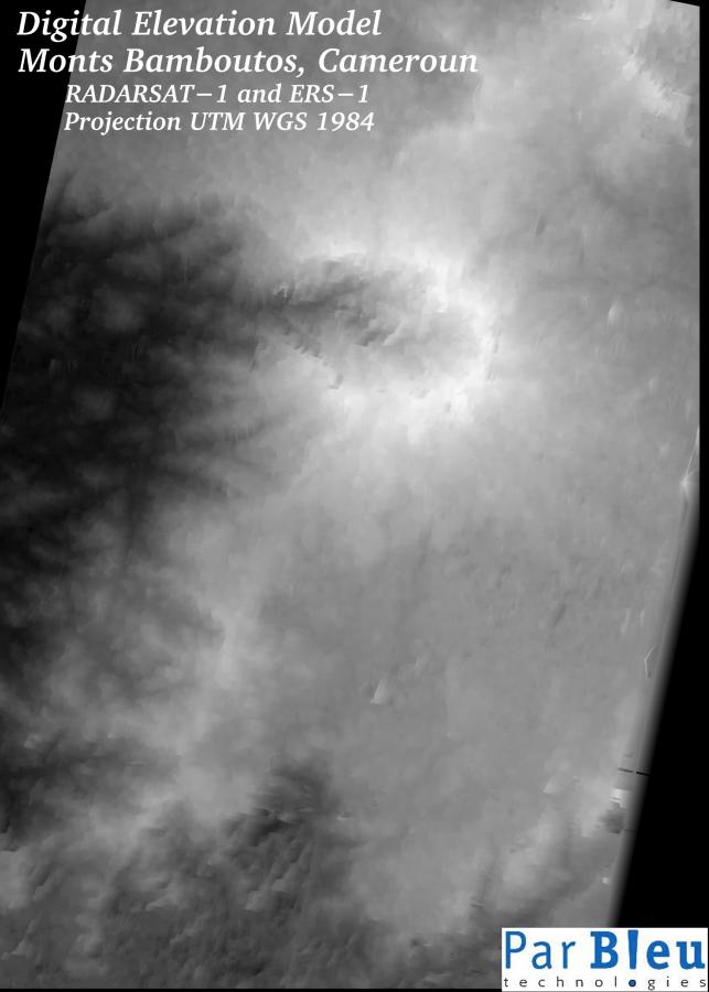
The Digital Elevation Model (DEM) has been generated by radargrammetry, using the RADARSAT-1 SAR image (beam S7, incidence angle 44°-49°) acquired on November 11, 2003 and two older ERS-1 SAR images (incidence angle 19°-26°) from February 12, 1996. The common coverage of the RADARSAT-1 and the ERS-1 images was wide enough to cover the whole area concerned by the project.
The Digital Elevation Model has been produced at a spatial sampling (planimetry) of 25 meters x 25 meters. The r.m.s. accuracy on the elevations is of 11 meters, globally.
The Digital Elevation Model covers the whole area of the project (latitude 5°15' to 5°50' N / longitude 9°50' to 10°15' E).
In this representation, brighter tones represent higher elevations.
The great caldera (of an ancient collapsed volcano) where the most damaging landslides happened is clearly visible near the center of the Digital Elevation Model.
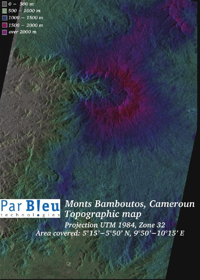
The topographic map has been produced by combining the orthorectified and speckle filtered RADARSAT-1 SAR image, with the Digital Elevation Model. Its original spatial resolution was 25 meters x 25 meters.
This topographic map provides a clear understanding of the relief of the mountains, and of the nature of the terrain.
The topographic map covers the whole area of the project (latitude 5°15' to 5°50' N / longitude 9°50' to 10°15' E).
Produced by PARBLEU TECHNOLOGIES Inc.
Operational partners of PARBLEU TECHNOLOGIES Inc. :
 |
 |
 |
| Privateers NV | Treemail | AP Formation |
Copyright (C) PARBLEU Technologies Inc., 2004