
|
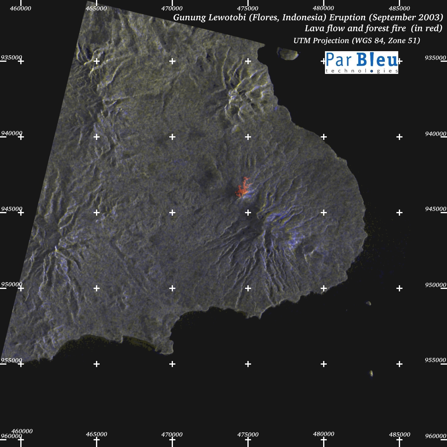
The map below (processing by ParBleu Technologies Inc.) is produced in cartographic projection UTM WGS 1984 (Zone 51),
at a spatial resolution of 20 meters x 20 meters.
UTM geographic coordinates are indicated on the map.
The Radarsat-1 radar imagery used to produce this map has been orthorectified (a digital terrain model has been produced for this purpose).
The size of the area shown is 30 x 30 kilometers.
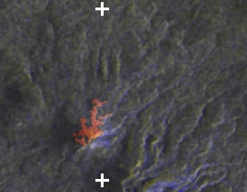
The lava flow and the forest burnt near to the top of the Lewotobi laki-laki volcano have been detected in the Radarsat-1 radar imagery.
They are marked in red on the map below.
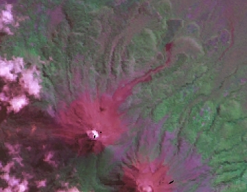
Note the difference with the 1991 eruption, as recorded by Landsat-5 :
| Landsat-5, 1991 | Radarsat-1, 2003 |
 |  |
On the other hand, damages to agriculture could unfortunately not be detected in the Radarsat-1 imagery, which proved unsensitive to this kind of features: no significant difference in the radar signal (between the September 2003 image and a reference 2002 Radarsat-1 image) has been measured, that could be interpreted as an actual change within the agricultural areas west of the Lewotobi volcano.
Produced by PARBLEU TECHNOLOGIES Inc.
Procurement of the original RADARSAT-1 SAR data: Canadian Space Agency, and Radarsat International Inc.
Original RADARSAT-1 images: Copyright Canadian Space Agency / Agence Spatiale Canadienne, 2003.
Copyright (C) PARBLEU Technologies Inc., 2003