
|
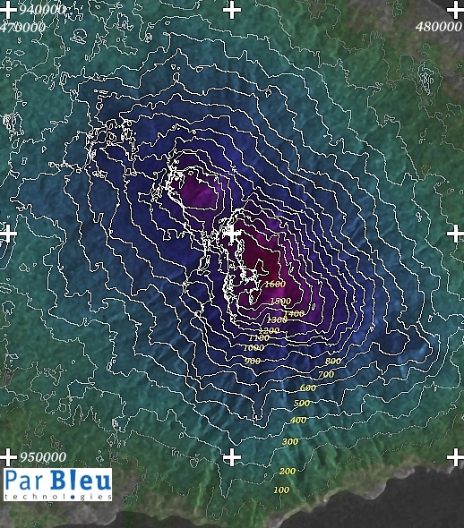
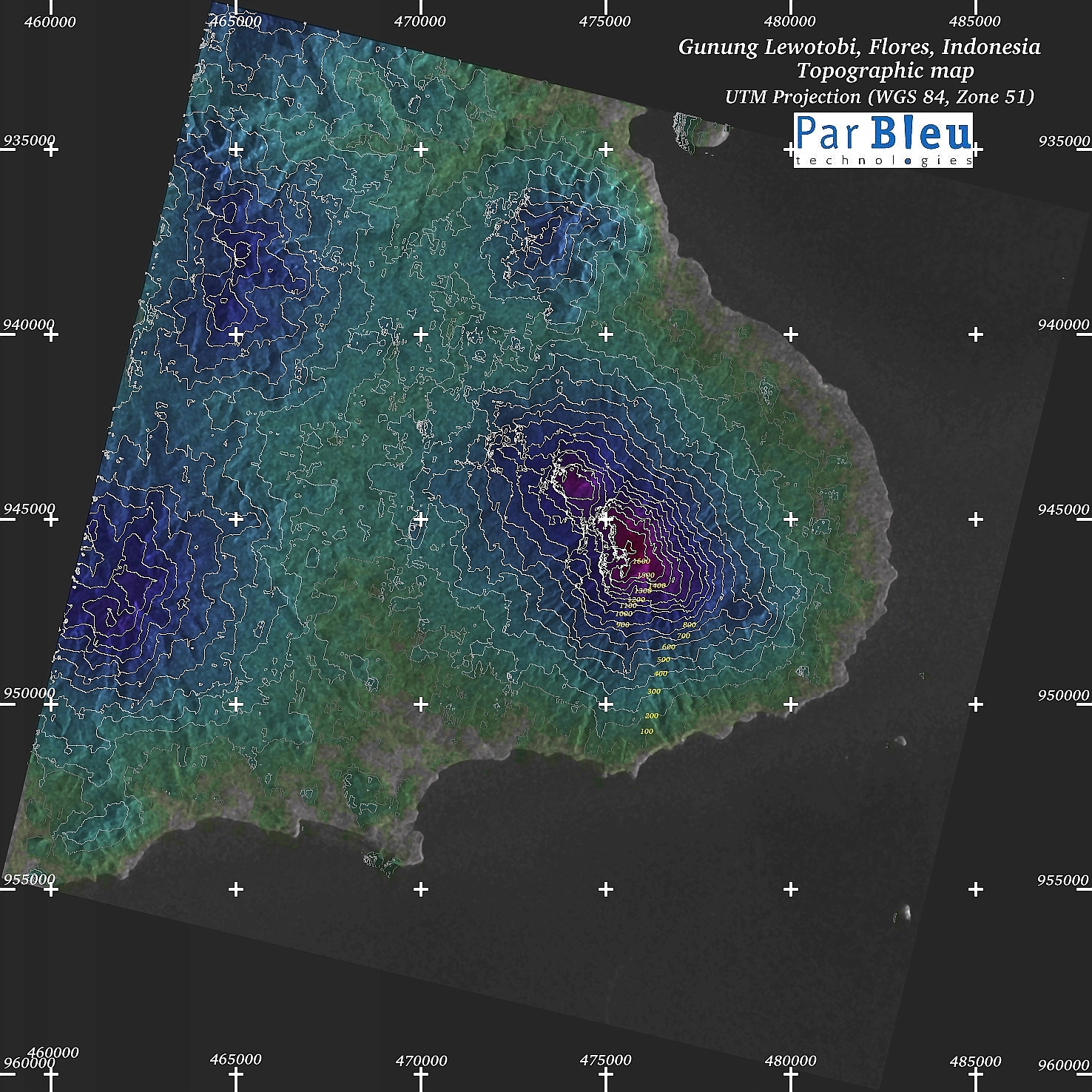
The maps below (processing by ParBleu Technologies Inc.) are produced in cartographic projection UTM WGS 1984 (Zone 51),
at a spatial resolution of 20 meters x 20 meters.
UTM geographic coordinates are indicated on the maps.
The Radarsat-1 radar imagery used to produce these maps have been orthorectified (a digital terrain model has been produced for this purpose, and to measure the elevations).
The size of the whole area shown is 30 x 30 kilometers.
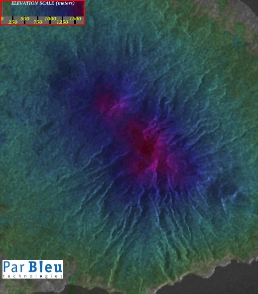
| Topographic map of the Lewotobi volcanoes: the Lewotobi laki-laki (1584 m)
is the northern one; the Lewotobi perempuan (1703 m) is the southern one. Elevation (in meters above sea level) is indicated in the legend. |
Topographic map of the Lewotobi volcanoes, with the elevation curves superimposed.
Elevation (in meters above sea level) is indicated in yellow. |
 |  |
The area represented is the same as on the map below.
Map projection is always UTM (WGS 84, Zone 51).
Exceptionally, spatial resolution is 40 x 40 meters on this 3-D map.
The grey plane indicates sea level (0 meters elevation).
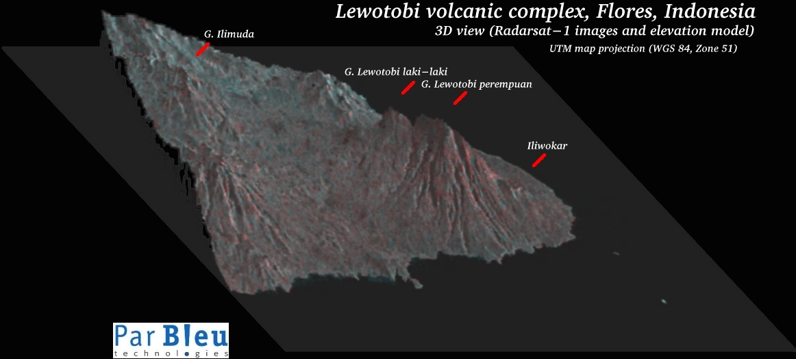
Elevation (in meters above sea level) is indicated in yellow.
Produced by PARBLEU TECHNOLOGIES Inc.
Procurement of the original RADARSAT-1 SAR data: Canadian Space Agency, and Radarsat International Inc.
Original RADARSAT-1 images: Copyright Canadian Space Agency / Agence Spatiale Canadienne, 2003.
Copyright (C) PARBLEU Technologies Inc., 2003