
|
The area shown extends over 40 x 40 kilometers.
This damage assessment map (processing by ParBleu Technologies Inc.) is produced in cartographic projection UTM WGS 1984 (Zone 37),
and has a spatial resolution of 20 meters x 20 meters.
UTM Coordinates :
Upper Left corner : Northing 1740000, Easting 240000
Lower Right corner : Northing 1700000, Easting 280000
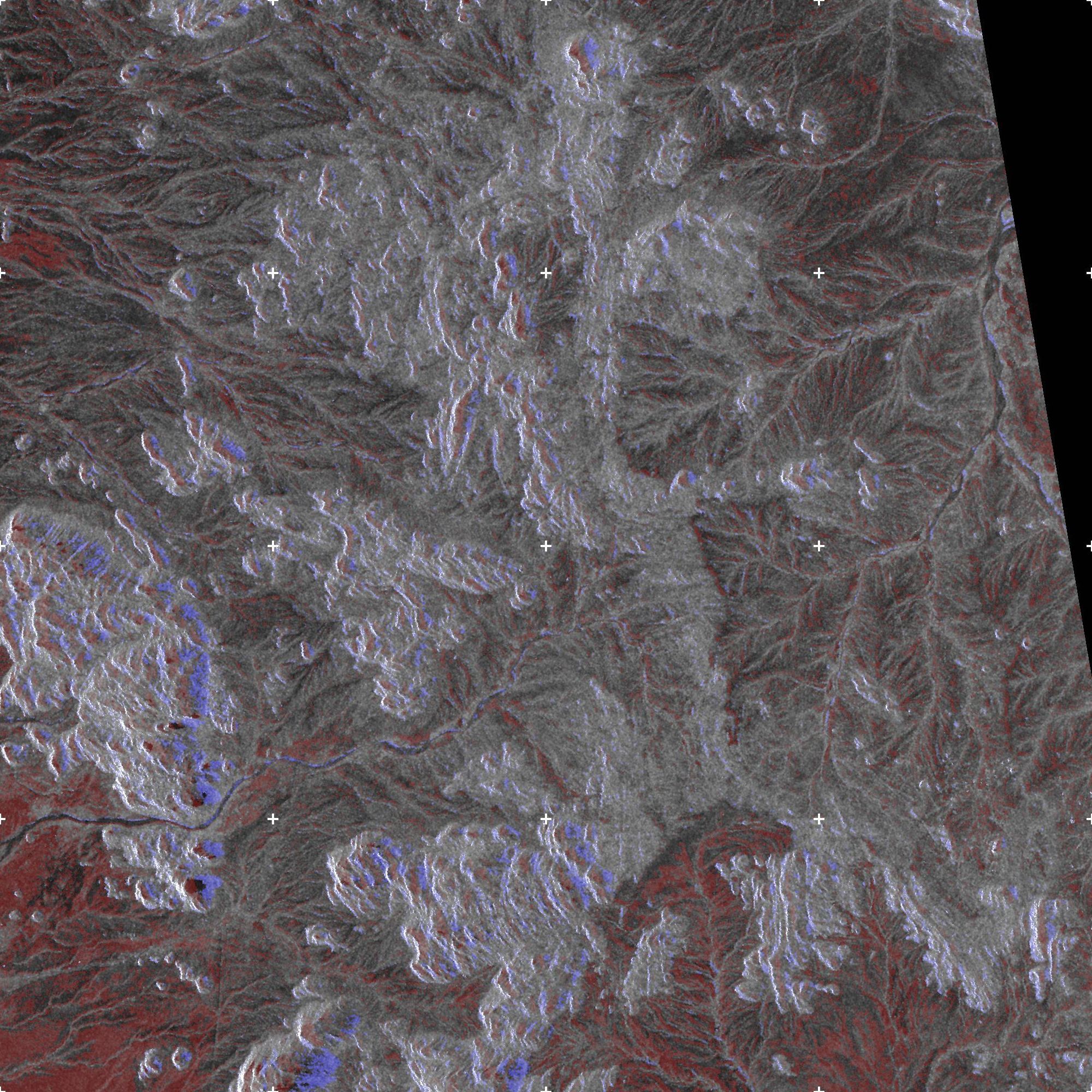
Damage assessment maps: Interpretation keys :
On this map, the areas exhibiting blue tones (with the exception of the mountain areas), along the affluent of the Gash river (running East-West on the southern part of the map), correspond to the areas that have been flooded.
The areas exhibiting red tones correspond to soils presenting a strong excess in moisture content, or to eroded terrains.
Agricultural fields located within such areas (as on the southeastern - i.e. bottom left - side of the map, on the Sudanese side of the border) are likely to be heavily damaged.
Urban areas exhibiting blue tones would correspond to damages suffered by housing.
The town of Sebderat (Eritrea) seems not to have suffered damages.
Areas exhibiting grey tones are those which have not been affected by the rains and the floods.
Produced by PARBLEU TECHNOLOGIES Inc. under mandate of the CANADIAN SPACE AGENCY.
(Standing Offer for Disaster Management Information Products and Services; PWGSC File Number 9F028-014927/A)
Procurement of the original RADARSAT-1 SAR data: Canadian Space Agency, and Radarsat International Inc.
Original RADARSAT-1 images: Copyright Canadian Space Agency / Agence Spatiale Canadienne, 2003.
Copyright (C) PARBLEU Technologies Inc., August 2003