
|
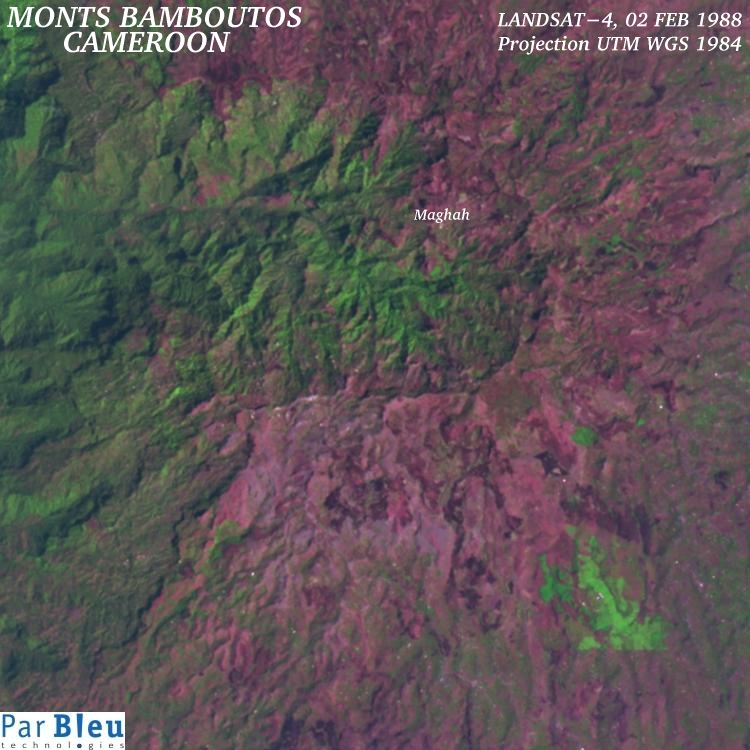
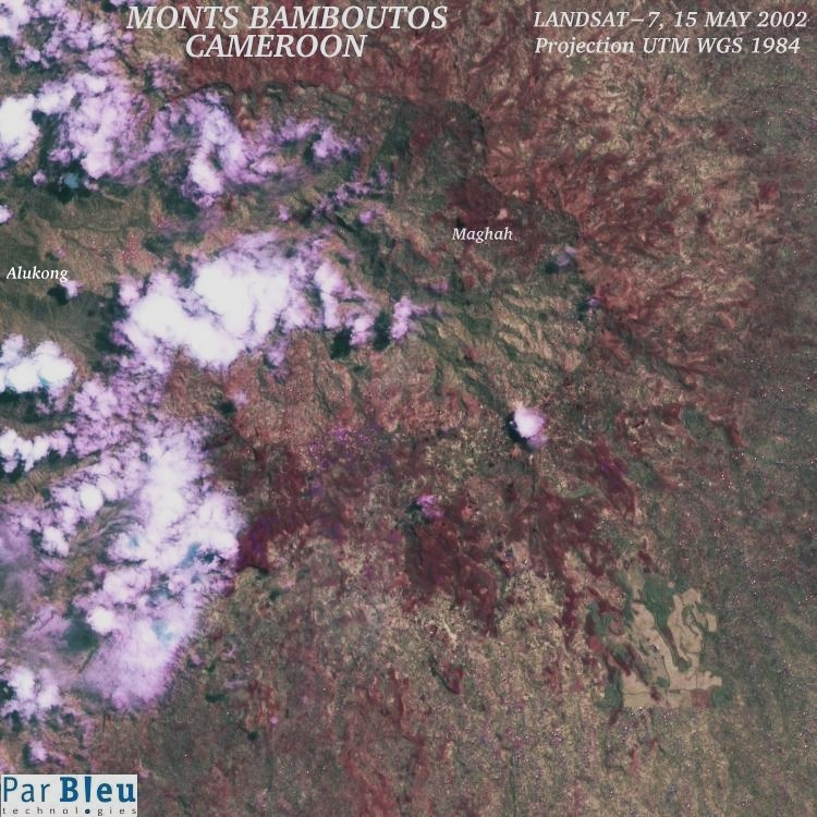
The LANDSAT-4 TM and LANDSAT-7 ETM+ images shown below have been acquired in 1988 and 2002, respectively (Courtesy of the University of Maryland, Global Land Cover Facility).
These images have been processed to improve their spatial resolution to 15 meters x 15 meters, but are shown here at 30 meters x 30 meters spatial resolution. They have been orthorectified and radiometrically corrected using the Digital Elevation Model built using the RADARSAT-1 and ERS-1 SAR (radar) images.
The subsets of these satellite images, which are shown below, cover a 22.5 x 22.5 kilometers wide area.
They show the great caldera of the Monts Bamboutos, the remnant of a 17 million years old volcano, now collapsed.
This caldera, rich in fertile soils, has attracted many farmers in the last years, and agriculture is practiced there, even on steep slopes exceeding 30°. These farmers contribute substantially to the development of the region.
Nevertheless, the increase in population means that forest, a useful natural resource in such a high altitude environment, has been intensively exploited, and also depleted to free the land for agriculture.
In the 1988 image, forest (in green tones) was covering most parts of the land inside the caldera. Forest covered also most of the valleys going down the inner and outer slopes of the caldera. Villages were sparse and small (individual houses can be seen as bright dots).
In May 2002, the number of small bright violet dots corresponding to the individual houses (by reflection of the solar light on the corrugated sheets used as roofing material) has considerably increased, which means that the population has increased in the same proportion in the meanwhile.
It can be observed that the forest (green tones) has regressed considerably within the caldera as the population grew. Forest has also regressed on the interior and exterior slopes of the caldera. The remaining forest appears more sparse and degraded than in 1988. Most soils, even on steep slopes, have been converted to agriculture.
Roads are now well visible, and are more numerous. Also the amount of bare soils (in violet), principally around the housing areas has increased.
All these factors together have dramatically raised the risk of landslides. The points from where landslides are likely to depart can be found by looking for light brown linear patterns located on steep slopes.
Examples of identification of potential landslides are illustrated for other places in the region (Bamenka and Djuttitsa).
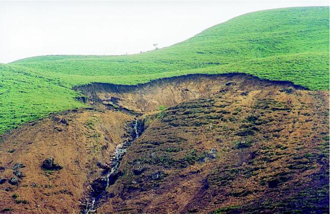
This photography has been taken within the caldera. It confirms the great number of detections of landslides of all sizes, and of potential landslides that are done in the processed May 2002 LANDSAT-7 ETM+ image of the caldera.
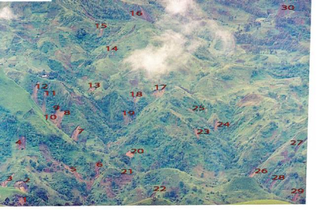
By photo-interpretation, as explained above, and as illustrated for the towns of Bamenka and Djuttitsa, it becomes easy to identify actual landslides and potential threats (as illustrated by the photography below) in the high-resolution (15 meters x 15 meters) processed version of the May 2002 LANDSAT-7 ETM+ image.
It appears that most of the landslides of 2003 could have been forecasted at least in 2002, as well as the future ones can be previsted.
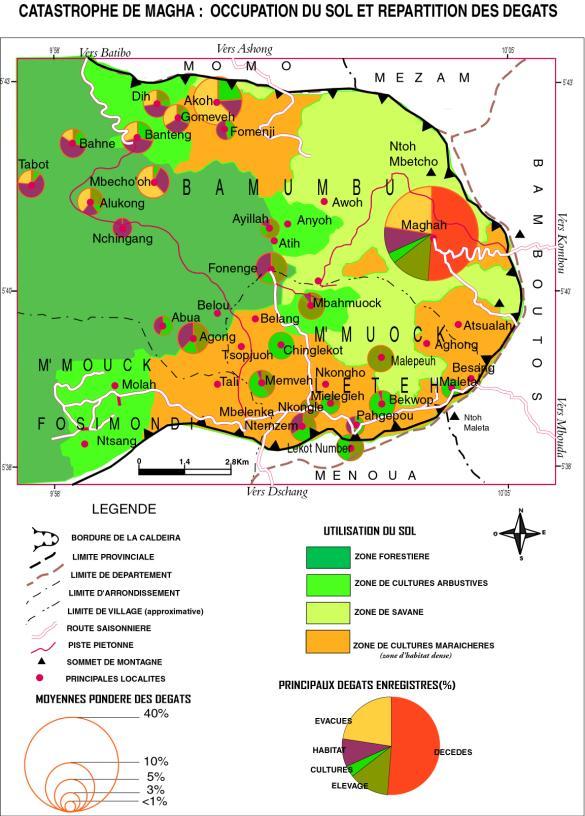
The preliminary evaluation of the damages, as observed on the field, may be compared to the analysis of this high-resolution processed May 2002 LANDSAT-7 ETM+ image :
Produced by PARBLEU TECHNOLOGIES Inc.
Operational partners of PARBLEU TECHNOLOGIES Inc. :
 |
 |
 |
| Privateers NV | Treemail | AP Formation |
Copyright (C) PARBLEU Technologies Inc., 2004