
|
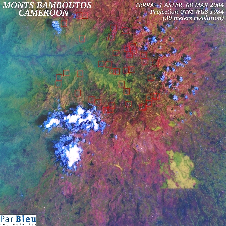
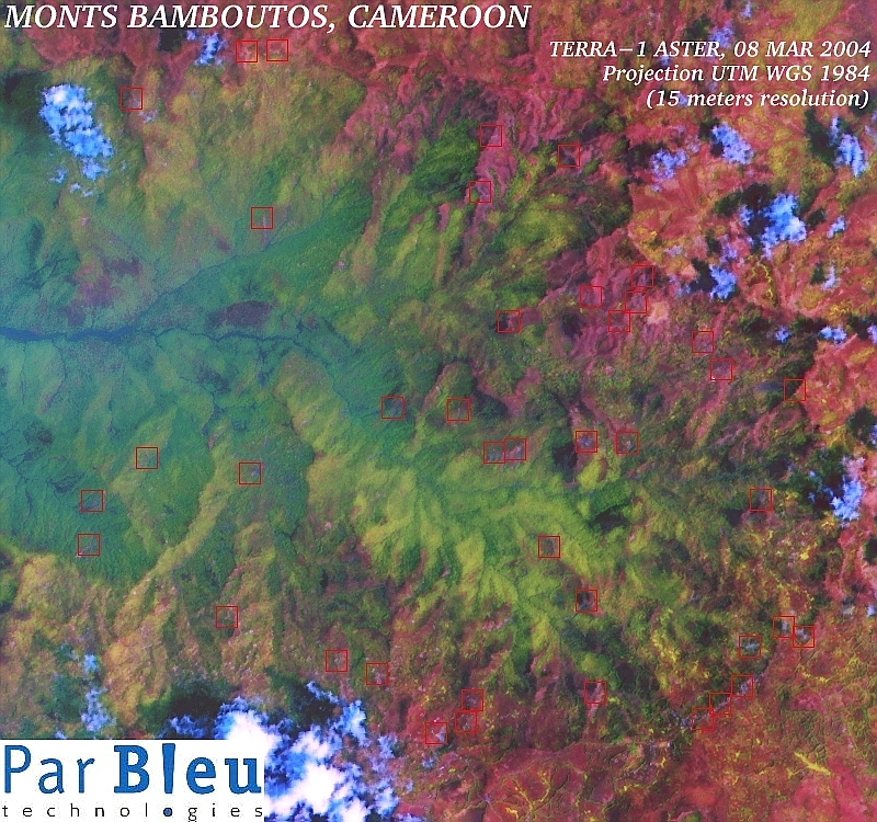
The TERRA-ASTER image shown below has been acquired on March 8, 2004 (Courtesy of NASA Earth Observatory, GSFC).
It covers the area of the Bamboutos Mountains in Cameroon, which had already heavily suffered of an important series of landslides in July 2003, during the rain season.
This image has been processed at its original spatial resolution of 15 meters x 15 meters. It is shown here at both 30 x 30 meters, and 15 x 15 meters spatial resolution.
It has been orthorectified and radiometrically corrected using the Digital Elevation Model built using the RADARSAT-1 and ERS-1 SAR (radar) images.
The subset of this satellite image (spectral bands 4, 3 and 2), which is shown below, covers an area of 22.5 x 22.5 kilometers.
It shows the great caldera of the Monts Bamboutos, the remnant of a 17 million years old volcano, now collapsed.
Potential landslides inside the caldera are marked at the center of the red squares.
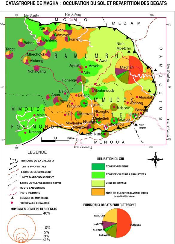
The preliminary evaluation of the damages, as observed on the field in the beginning of year 2004, may be compared to the analysis of this high-resolution processed March 2004 TERRA-ASTER image :
Related Pages at the NASA Earth Observatory (June 02, 2004) :
|
|
|---|
Produced by PARBLEU TECHNOLOGIES Inc.
Procurement of the TERRA-ASTER image: Courtesy of MITI, ERSDAC, JAROS, and the
U.S./Japan
ASTER Science Team.
Operational partners of PARBLEU TECHNOLOGIES Inc. :
 |
 |
 |
| Privateers NV | Treemail | AP Formation |
Copyright (C) PARBLEU Technologies Inc., 2004