|
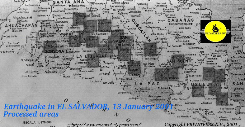
El Salvador: Damage identification and Evalution
after the earthquake of
January 13, 2001
 For the first time in history of Spaceborne Earth Observation,
identification and evaluation of the damages have been delivered on-site,
in near REAL-TIME, to local authorities, rescue teams and humanitarian
organizations.
For the first time in history of Spaceborne Earth Observation,
identification and evaluation of the damages have been delivered on-site,
in near REAL-TIME, to local authorities, rescue teams and humanitarian
organizations.
According to the European Space Agency it helped to save
lives.
Damage identification and evaluation was carried out with archived
SPOT-4 data (year 2000 data) in combination with actual SPOT-1 and SPOT-4
data acquired in January 2001.(Programmation of the January 2001 acquisitions was
executed by SpotImage).
Within 24 hours of data reception near complete satellite
pin pointing the affected areas (UTM, WGS 1984, resolution 10x10m) were produced and
delivered to the rescue teams of the "Sécurité Civile Française".
Maps of the following zones are online:
This project was carried out under contract of the "Centre Nationale d'Etudes Spatiales", the French Space Agency.
|